Analysis of GIS maps used to communicate Environmental Health Risk
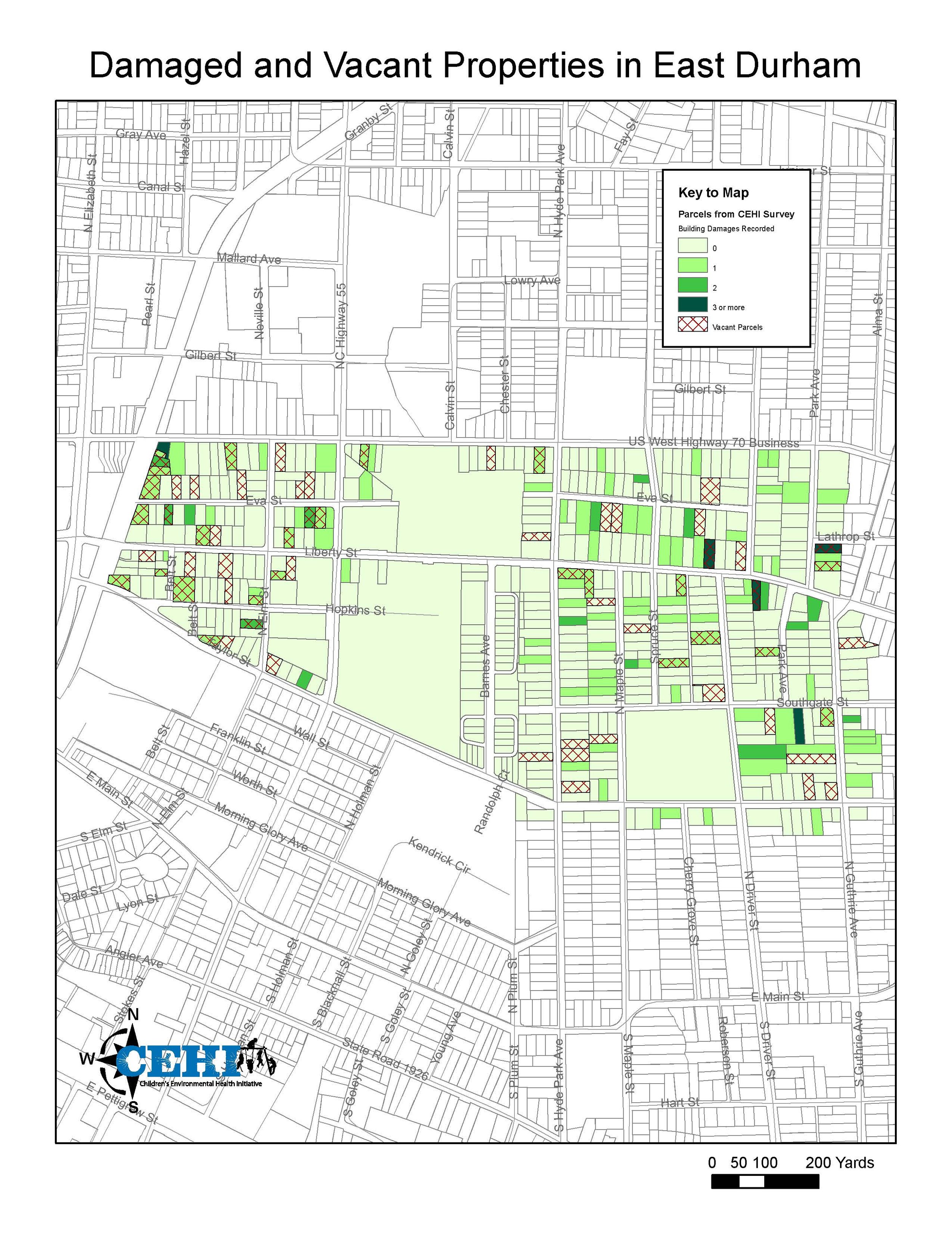
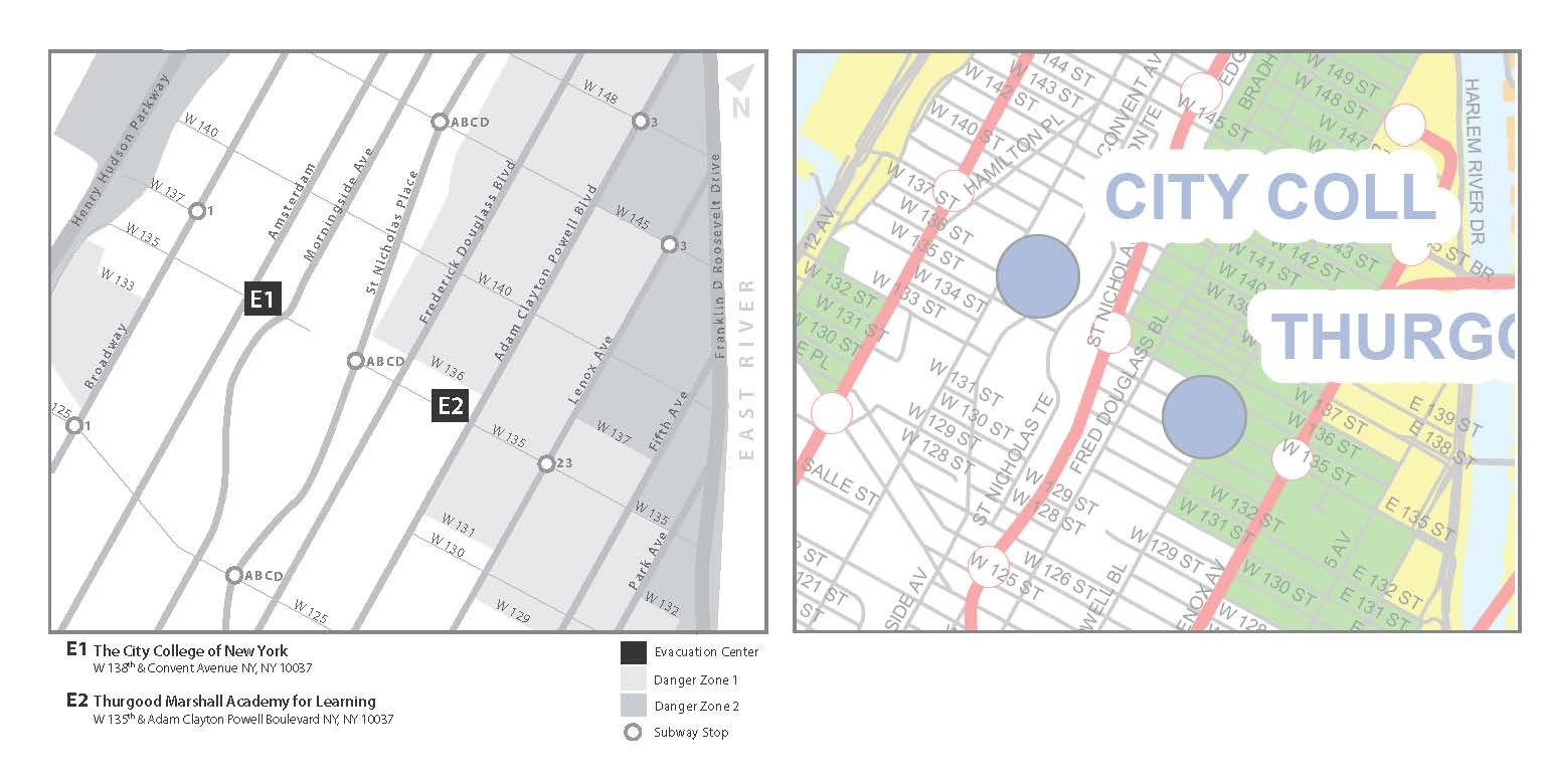
The Geographic Information Systems (GIS) output of the Children’s Environmental Health Initiative (CEHI) at the Nicholas School for the Environment, at Duke University, directed by Marie Lynn Miranda, was a novel method of presenting data about populations in specific geographic locations to the target at-risk populations themselves. Zarcadoolas and Krishnaswami conducted a text readability analysis of the CEHI maps for presentation to the CEHI staff in a workshop (June 8, 2006).
Understanding and unpacking the inherent complexity of the GIS maps when used with vulnerable populations is greatly needed. The maps had to be simple and direct in order to reach audiences with lower literacy levels, and they had to allow for the inclusion of many layers of information to serve the needs of community decision makers.
Role
Information designer
User researcher
GIS Maps